


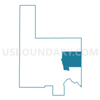
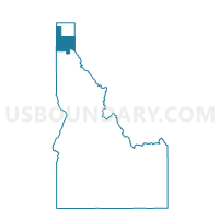
Hope Voting District, Bonner County, Idaho
About
Outline

Summary
| Unique Area Identifier | 563815 |
| Name | Hope Voting District |
| County | Bonner County |
| State | Idaho |
| Area (square miles) | 164.30 |
| Land Area (square miles) | 143.90 |
| Water Area (square miles) | 20.40 |
| % of Land Area | 87.58 |
| % of Water Area | 12.42 |
| Latitude of the Internal Point | 48.24431150 |
| Longtitude of the Internal Point | -116.19234500 |
Maps

Graphs
Select a template below for downloading or customizing gragh for Hope Voting District, Bonner County, Idaho


Neighbors
Neighoring Voting District (by Name) Neighboring Voting District on the Map
- Clark Fork Voting District, Bonner County, ID
- Gamlin Lake Voting District, Bonner County, ID
- Lakeview Voting District, Bonner County, ID
- Oden Voting District, Bonner County, ID
- Precinct 1, Sanders County, MT
- Selle ll Voting District, Bonner County, ID
Top 10 Neighboring County Subdivision (by Population) Neighboring County Subdivision on the Map
- Sandpoint CCD, Bonner County, ID (18,701)
- Blanchard-Glengary CCD, Bonner County, ID (14,485)
- Thompson Falls-West End CCD, Sanders County, MT (5,988)
- Troy CCD, Lincoln County, MT (3,576)
- Clark Fork CCD, Bonner County, ID (2,398)
Top 10 Neighboring Place (by Population) Neighboring Place on the Map
Top 10 Neighboring Elementary School District (by Population) Neighboring Elementary School District on the Map
Top 10 Neighboring Secondary School District (by Population) Neighboring Secondary School District on the Map
Top 10 Neighboring Unified School District (by Population) Neighboring Unified School District on the Map
Top 10 Neighboring State Legislative District Lower Chamber (by Population) Neighboring State Legislative District Lower Chamber on the Map
- State House District 1, ID (40,210)
- State House District 2, ID (35,917)
- State House District 2, MT (10,711)
- State House District 13, MT (10,394)
Top 10 Neighboring State Legislative District Upper Chamber (by Population) Neighboring State Legislative District Upper Chamber on the Map
- State Senate District 1, ID (40,210)
- State Senate District 2, ID (35,917)
- State Senate District 7, MT (20,946)
- State Senate District 1, MT (19,687)
Top 10 Neighboring 111th Congressional District (by Population) Neighboring 111th Congressional District on the Map
Top 10 Neighboring Census Tract (by Population) Neighboring Census Tract on the Map
- Census Tract 9502, Bonner County, ID (8,477)
- Census Tract 2, Sanders County, MT (5,988)
- Census Tract 9509, Bonner County, ID (4,278)
- Census Tract 5, Lincoln County, MT (3,576)
- Census Tract 9501, Bonner County, ID (2,398)
Top 10 Neighboring 5-Digit ZIP Code Tabulation Area (by Population) Neighboring 5-Digit ZIP Code Tabulation Area on the Map
- 83864, ID (17,076)
- 83860, ID (6,119)
- 59935, MT (3,576)
- 83811, ID (1,411)
- 83836, ID (1,033)
- 83803, ID (744)
- 59844, MT (736)